
5th Grade
Posts used for in-class lessons or activities for fifth grade.
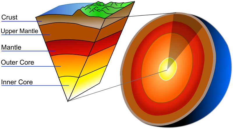
Earth Dynamics
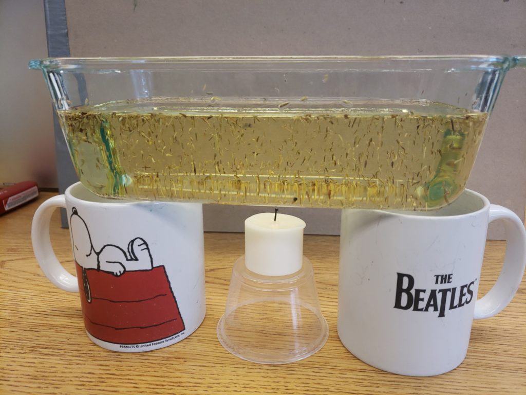
What do you notice? What does it have to do with volcanoes and earthquakes?

Plotting in Google Earth
If you don’t want to follow the video directions. Here are the directions to read.
- Open Google Earth
- Go into the 3 bars and check that you are logged in.
- Scroll down to settings and click.
- In the settings window, scroll all the way down to the bottom.
- Turn on the KML – “Enable KML file import” – the button should be blue.

- Keep Google Earth open.
- Open the Volcano List. This will open in a new tab.
- Copy the name of one of the volcanoes by highlighting the name and clicking on control C (or right click and copy).
- Click on the tab for Google Earth.
- Find the search/magnifying glass.
- Paste the volcano name into the search field by using control V (or right click and paste).
- Click the magnifying glass or hit return.
- The map will fly in to that location.
- A picture will pop up that will have the bookmark symbol in the bottom left corner. Click that to save the location.
- Go back to the volcano list and copy another name, and repeat.
- Finish entering all the volcanoes – there are quite a few!!
If you don’t want to follow the video directions. Here are the directions to read.
- Click here to download the KML file.
- Open Google Earth
- Go into the bookmarks from the side menu in Google Earth.
- Click on “Import KML File.” This will be above the bookmarks. If you see the word “Done” instead, click on that first, then the import option will show up.
- Click on upload file.
- Find the 2.5_month_age_animated_link.kml file in your downloads folder.
- Click on the file, then open.